
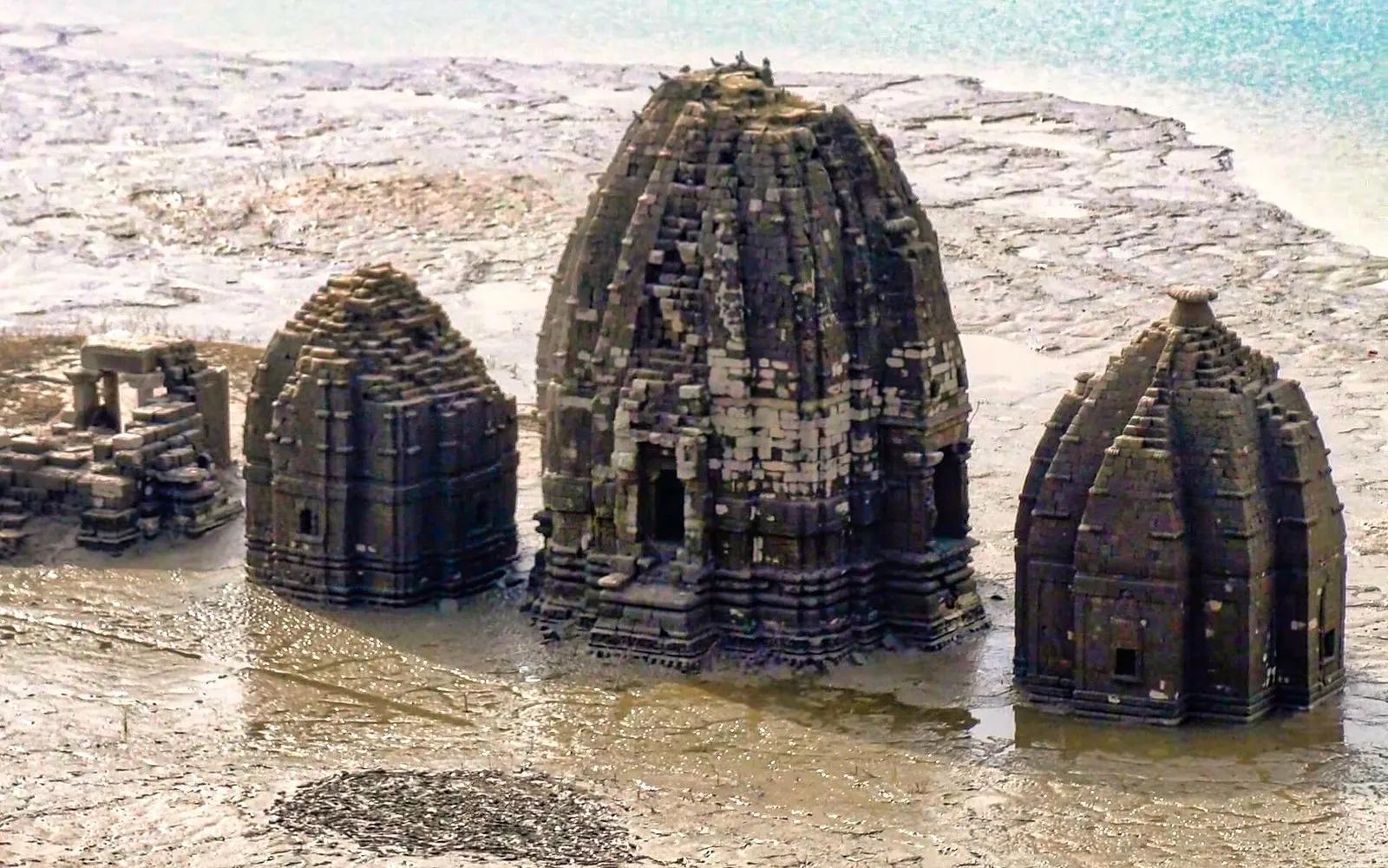
Lower Himachal: The Four Districts Nobody Visits
Himachal Pradesh has twelve districts. Travel blogs cover five of them. Shimla, Kullu, Kangra, Kinnaur, Lahaul-Spiti, and then the writing just stops, as if the map runs out of ink south of the Dhauladhar. I grew up in Kullu, which makes me part of the problem: for most of my life I treated the bottom third of my own state as the boring bit you drive through on the way to Delhi.
This article is about the four districts that get pretended out of existence. Una. Bilaspur. Hamirpur. Sirmaur. Between them they hold the biggest natural lake in Himachal, a 226-metre dam that drowned a princely capital, a Shaktipeeth with a working ropeway, the room where the second-most-important Sikh scripture was written, the highest summit in the entire Shivalik range, and a set of medieval stone temples that spend most of the year underwater and walk out of the reservoir every summer like something out of a myth.
When a photographer posted shots of Una on r/HimachalPradesh, the top reply was "No one is visiting una anyways bruh dont worry" (u/Alternative_Hand_830). That comment is this whole article in one line. Nobody is visiting, and the rest of this piece is an inventory of what those empty highways drive straight past.
- The four districts
- Una, Bilaspur, Hamirpur, Sirmaur (southern HP, Shivalik foothills)
- Elevation band
- 350 m (Una plains) to 3,647 m (Churdhar Peak)
- Best season
- October to March for the lowlands; April 15 to November for Churdhar
- Headline sights
- Submerged temples of old Bilaspur, Renuka Lake, Paonta Sahib, Churdhar, Naina Devi
- From Chandigarh
- Una and Nahan about 2 hours, Bilaspur about 3, Hamirpur about 4
- Crowds
- Pilgrims in lakhs at the temples, tourists in single digits everywhere else
Why the south of Himachal got deleted from the map
Three reasons, and none of them are good ones.
Geography first. These districts sit in the Shivaliks, the outermost and lowest wrinkle of the Himalaya, which puts Una town at 369 metres and Nahan, the loftiest district capital of the four, at a modest 932. No snow line, no cedar gloom, no white wall of peaks behind the bus stand, and a June afternoon in the Una plains will cook you like a paratha. If your definition of Himachal was formed by an Instagram reel shot at Rohtang, this region reads as a rounding error of Punjab, and Punjabis agree: "I am from Kangra and Una doesn't really give the 'pahadi' vibes you know. It feels more like Punjab. It is comparatively hot there compared to the upper Himachal and people mostly speak Punjabi" (u/outlawent21).
Transit second. All four districts work as corridors, roads engineered to deliver you somewhere more famous. Bilaspur is the lunch stop on every Delhi to Manali bus; the conductor yells fifteen minutes and nobody even looks up at the lake outside the dhaba window. Una is the rail gateway from Punjab, Hamirpur is the connecting tissue between Bilaspur and Kangra, and Sirmaur hangs off the bottom-right corner of the state where no tourist circuit goes. Roads full of people, all of them leaving.
Perception third, and this one is on us, the people who write about Himachal. The temples here pull crowds that would make a Manali hotelier weep. Naina Devi and Chintpurni each see millions of pilgrims a year. But pilgrims do not count as tourists in the travel-content economy, so the coverage rounds down to zero. When I went looking for Reddit threads about travelling in these four districts, the most engaged conversations were about a college campus in Hamirpur and a road accident. A Sirmauri redditor put it gently under a Renuka fair post: "Happy to see more sirmauris, feels like there aren't many here from Sirmaur" (u/Ishan_Kishan25).
The silence is the opportunity. You will have all of this nearly to yourself.
Bilaspur: the district that drowned its own capital
Start with the story, because there is no story like it anywhere else in India. Old Bilaspur was the capital of Kahlur, a princely state on the Sutlej. When the Bhakra Dam went up, the government moved the town to higher ground and let the reservoir take the rest. The water rose through the early 1960s and swallowed the bazaar, the palace grounds, and 28 temples, some of them dating back to the 8th century. The residents climbed the hill. The gods stayed.
Every year, when Gobind Sagar drops, the temples come back. Cracked silt flats, and then these blackened Nagara-style shikharas standing in the mud like they never heard about the dam. About eight of the 28 still surface in a good low-water year; the rest have crumbled somewhere under six decades of reservoir. The state has a Rs 1,400 crore plan, with a pre-feasibility study done by Larsen and Toubro, to lift the main group onto an artificial island with a foot bridge so they stay visible year-round (The Tribune). Until that happens, the viewing window is roughly late spring into early summer, before the monsoon refills the lake. Even on r/HimachalPradesh, where a photo of the temples drew quiet awe, the first comment was a plea: "You should share some history of this place. So as to promote it" (u/Lowcrbnaman). Consider this article my attempt.
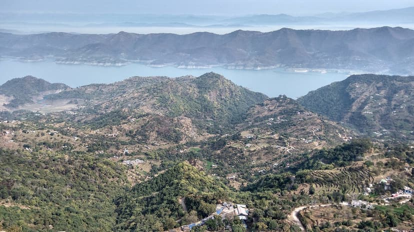
The lake itself has changed character recently. In 2026 the Chief Minister inaugurated full water sports at Mandi Bharari: jet skis, shikara rides, houseboats, and the first cruise vessel in the state, a 45-seater, with a 30-km cruise route planned from Harnod up to Tattapani near Shimla (The Tribune). ETV Bharat quoted the CM in Hindi: "गोविंद सागर झील में अब क्रूज, शिकारा, हाउसबोट, जेट स्की और वाटर स्कूटर जैसी गतिविधियां पर्यटकों के लिए उपलब्ध होंगी।" The lake that buried a town is being repackaged as a water playground, and honestly the irony works in your favour: the boat rides go right over the drowned city.
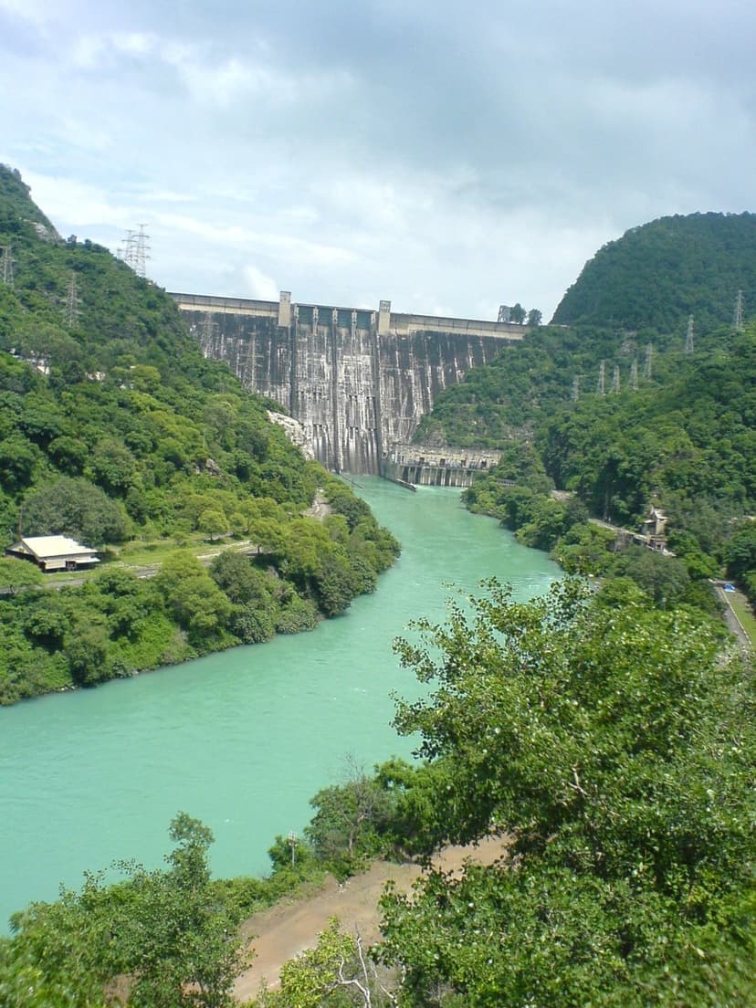
Bhakra Dam anchors the southern end. 226 metres of concrete across the Sutlej gorge, finished in 1963, the structure Nehru called the new temple of resurgent India. Here is the practical detail every blog leaves out: you cannot simply drive up to it. Visits require a free pass from the BBMB Public Relations Office in Nangal, open roughly 8 am to 3 pm, with a valid photo ID. A basic white pass lets you cross the top; the red pass covers the inner works. Foreign nationals are not allowed at all, a security rule that has outlived several governments. Indian travellers, carry your Aadhaar and budget an hour for the formality.
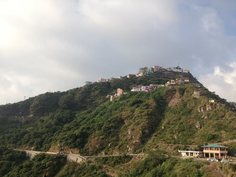
Above the lake sits Naina Devi, one of the 52 Shaktipeeths, where the eyes of Sati are said to have fallen. The temple crowns a triangular ridge with Gobind Sagar on one side and, on a clear day, the white domes of Anandpur Sahib across the valley in Punjab. There is a ropeway from the base if the 1.25 km stepped climb does not appeal; cabins run every 15 minutes or so, though the system shuts for maintenance on the first and third Wednesday of the month. During Shravan and Navratri the hilltop heaves with lakhs of pilgrims. Come on an ordinary weekday morning instead and you can hear the bells echo off the water.
One piece of bad news, because you deserve honesty more than a brochure. The shoreline near the towns is not clean. A Una local wrote it plainly under those lake photos: "I feel so sad seeing the lake now. It's so sad that our people have zero civic sense. There's so much garbage on the shores now. We don't deserve good things" (u/bgangster). He is right. The wide views are glorious and the waterline is full of plastic. Pack out what you bring in.
If you are in Bilaspur in March, the Nalwari cattle fair is a four-day spectacle of livestock trading and traditional wrestling that has been running since 1889 and sees essentially zero outside visitors. And 8 km out of town on NH-205, the Kandrour bridge hangs about 80 metres over the Sutlej; when it opened in 1965 it was counted among the highest bridges in Asia. Worth slowing down for. Not worth a detour on its own.
Una: the doormat district (and why you should stop wiping your feet)
Una is where Himachal begins if you arrive from Punjab, and it does not look like the Himachal in your head. Flat fields, Punjabi on the signboards, Punjabi in the air. "Una is a plain region, main language there is Punjabi. You won't feel like you are in Himachal" is how u/genome_walker briefed an incoming student. All true. Also true: the district holds one of the most visited temples in north India and sits on a Sikh history corridor that nobody has ever bothered to write up as a travel route.
Chintpurni first. One of the 52 Shaktipeeths, the temple of Chhinnamastika Devi, about 40 km north of Una town in the first folds of the Shivaliks. The pilgrim traffic from Punjab, Haryana and Delhi is colossal, the temple corridor lined with devotees tying red threads for wishes. From the ridge you can pick out Bhakra and the spread of Gobind Sagar. Between Chintpurni, Naina Devi and Jwalaji just over the Kangra border, you have three major Shaktipeeths inside a two-hour driving triangle, which is the kind of circuit that would have its own glossy brochure in any other state. Here it has nothing. Take the HRTC bus; the temple routes run constantly.
Then the Sikh corridor. Anandpur Sahib, the birthplace of the Khalsa, sits just across the district border on NH 503. The reservoir to its north is named Gobind Sagar after the tenth Guru. Follow the Guru's actual life east and you reach Paonta Sahib in Sirmaur, where he spent four creative years and fought the Battle of Bhangani; on the way, the town of Nadaun in Hamirpur is where he fought the Battle of Nadaun in 1691 and described it in his autobiographical Bachitra Natak. String those together and you have a three-day Guru Gobind Singh trail through districts no travel agency has ever sold. I find that genuinely strange. It is sitting right there.
What I cannot tell you is what Una's interior villages feel like at dusk, because the honest answer is that, like every other Kullu person, I have mostly seen Una from a bus window. The locals carry the affection we outsiders have not earned yet. "My origins are from Una too, and I love everything about it. I wish to retire there someday" (u/amitaquarius).
Good pictures don't change places, they reveal them.
That line is from u/GalleryofArt, a Una local defending his hometown after posting lake photos good enough that another commenter admitted "I never imagined pictures could make a place like UNA so beautiful". He also wrote that living beside Gobind Sagar means living with "serenity, stillness, and a kind of raw" scale that engineering accidentally gifted the district. Five generations of travel writers skipped Una. The Una subreddit posters are doing the job themselves.
Hamirpur: the smallest district, the sharpest people
Hamirpur has no famous viewpoint, no lake, no pass. What it has is an outsized reputation inside the state: smallest district by area, highest literacy in Himachal, and a pipeline of soldiers, teachers and engineers so steady that the standing joke says Hamirpur runs the state while the rest of us pose for photographs. NIT Hamirpur anchors the education economy. The hills are low, pine-covered, gentle.
A visitor from the plains caught something real about this stretch of road on his first trip in: "it's more like the very moment you enter the first set of hills from a plain area...that transition is actually beyond words and pictures" (u/Honest-Humor-9102). That entry moment, plains becoming foothills over maybe twenty minutes of driving, is the signature experience of lower Himachal, and Hamirpur is where it happens most softly.
The district's spiritual heavyweight is Deotsidh, the cave shrine of Baba Balak Nath on the Bilaspur border, where the deity sits in a hillside cave above the Shahtalai valley and lakhs of devotees arrive each year, peaking around the Holi fair in March. One custom worth knowing before you go: by tradition women do not enter the cave sanctum itself and have darshan from a platform facing it. The scale of devotion here is enormous and almost perfectly invisible to travel media; a graduate who spent four years at NIT Hamirpur replied to a tourist who had visited, "Bro what 😭😭 hearing about this mandir for the first time, spent 4 years there and never even knew" (u/Opening_Garbage_9052). Even people living in the district miss it.
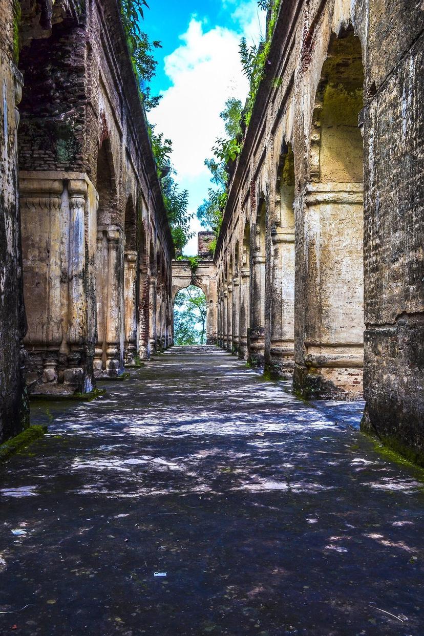
The cultural one is Sujanpur Tira, 22 km from Hamirpur town above a wide bend of the Beas. Raja Abhay Chand of the Kangra Katoch dynasty built the fort on the tira, the hilltop, in 1758, and under Maharaja Sansar Chand it became the court where the Kangra school of miniature painting flowered. Five temples survive inside, including the Gauri Shankar temple, along with the Baradari durbar hall and patches of Ramayana fresco that have outlasted both the empire and the 1905 earthquake. The arcades are slowly going back to the hill, renovation crawls along, and on most weekdays you will share the whole complex with pigeons. Below it spreads the chaugan, one of the biggest open grounds in Himachal, which every March hosts the state-level Holi fair, four days of colour and folk performance that is the largest Holi celebration in the state. Our festival calendar has the dates.
Pair Sujanpur with Nadaun, half an hour west on the Beas, for the Guru Gobind Singh battle history and slow river-town ghats. Locals fish for mahseer here. Nobody is in a hurry. It suits the district.
Sirmaur: the forgotten southeast, and the best of the four
I will say it flat out: Sirmaur is the most rewarding of these districts for a traveller, and if it sat anywhere north of the Dhauladhar it would be famous. It borders Uttarakhand along the Yamuna, it rises from sal forest to an 3,647-metre summit, and it has a colonial-era capital that time forgot to renovate.
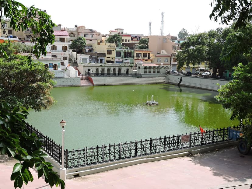
Nahan first. Founded in 1621 by Raja Karan Prakash as the seat of the Sirmaur princely state, 932 metres up, high enough for a breeze and low enough to skip the bus-sickness. The old town curls around Rani Tal, the palace pond, past Edwardian-era civic buildings, a Victorian-style clock, and bazaar lanes that still follow the seventeenth-century street plan. The reason it stayed like this is almost funny: the railway never came, the highways went elsewhere, and tourism followed the railways and highways. What you get is the hill-station texture Shimla had before Shimla got famous, at one-tenth the noise. September to November is the sweet window, when monsoon haze lifts off the Shivaliks.
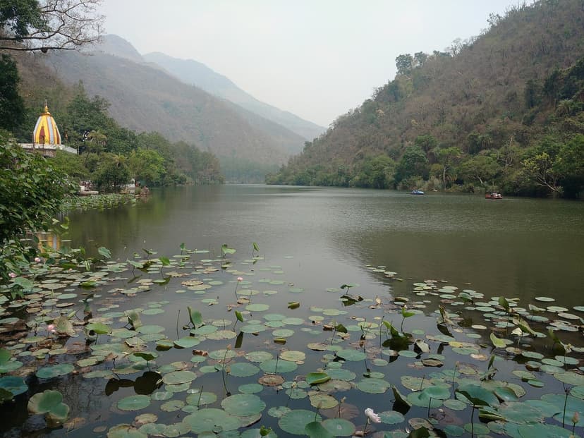
Thirty-seven kilometres east is Renuka Ji, the largest natural lake in Himachal Pradesh, 3,214 metres around at 672 metres elevation, a Ramsar wetland since 2005, wrapped in a small wildlife sanctuary loud with sambar and barking deer. The lake outline is said to trace the reclining body of the goddess Renuka, mother of Parshurama. The walk around the shoreline takes about 45 minutes under big sal trees, lotus pads crowding the temple end where paddle boats put out from a small ghat.
And every November the lake hosts the event that should be on every culture traveller's list: the international Renuka Ji fair, held over the closing days of Kartik, which in 2026 falls on 20 to 24 November. The story underneath it is the tenderest in the Himachali festival canon. Parshurama, the son, returns once a year to visit his mother. Village deities arrive in palanquins from across the district to witness the reunion. A redditor who watched the palkis come down confirmed the tradition is alive and walking: "this palaki comes from a nearby village and gather at shri renuka ji international fair held in November" (u/KeySlow4155). Most HP fairs are commerce with a deity attached. This one is a family visit with a fairground attached, and the difference shows.
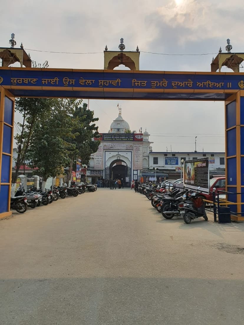
South on the Yamuna sits Paonta Sahib, and if you know one thing about Sirmaur it should be this. Guru Gobind Singh came here in 1685, still in his teens, at the invitation of the Sirmaur raja, and stayed four years on the riverbank. Those years produced much of the Dasam Granth, the second scripture of Sikhism. The gurdwara complex remembers a court of poets: the Kavi Darbar Asthan where 52 poets recited, the spot where the young Guru held turban-tying contests, a museum with weapons and pens. The langar feeds thousands daily, free, to anyone who walks in. Sikh travellers know all this. Almost nobody else does, which baffles the people who have been: "Paonta sahib is the mist peaceful space i have been to" wrote u/No_Jackfruit_9830 under a photo set from the town, typo and all, and a Dehradun rider remembered "the weekly bike ride to Paonta Sahib from dun, for the delicious langar and kadha prashad" (u/FART_6_9_). Evening aarti by the Yamuna, with the river running shallow over gravel bars, is the single most underrated religious-site experience in the state.
Near Nahan, the Suketi fossil park displays Shivalik fossils, prehistoric elephants and giant tortoises pulled from these very hills, one of the few open-air fossil parks in Asia. Take it as a curiosity stop with kids rather than a destination.
Churdhar: the trek hiding in the wrong district
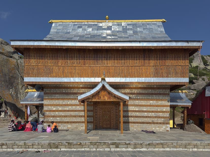
Sirmaur also owns the one genuine high-mountain experience in lower Himachal. Churdhar, 3,647 metres, 11,965 feet, is the highest peak in the entire Shivalik range, locally called Churi Chandni, the bangle of snow, for the silver ring the winter cap throws around the summit. People in Shimla watch it from their balconies. People in Dehradun can see it on a clean morning. Hardly anyone climbs it, relative to what a peak this accessible would attract in Uttarakhand.
The standard route starts from Nohradhar village, 16 to 18 km of trail through deodar and oak to alpine meadow, normally done with a night at the Teesri dhar or Jam Nallah midway camps, five to eight hours up for a fit walker. There are two seasonal dhabas on the route selling boiled noodles, tea and shelter, and waterfalls to refill bottles, all of which a trekker who did it itemised for a doubtful international audience on r/CampingandHiking: "There are 2 small base points in between where one can have foods like boiled noodles or coffee and tea and they provide shelters too... there are several small waterfalls from where one can fill up fresh water...trek is risky as there are frozen [glaciers]" (u/jinxed_horizon). A more recent group of six left Nohradhar at 10 am and touched the temple by 3 pm (u/FineAd7511).
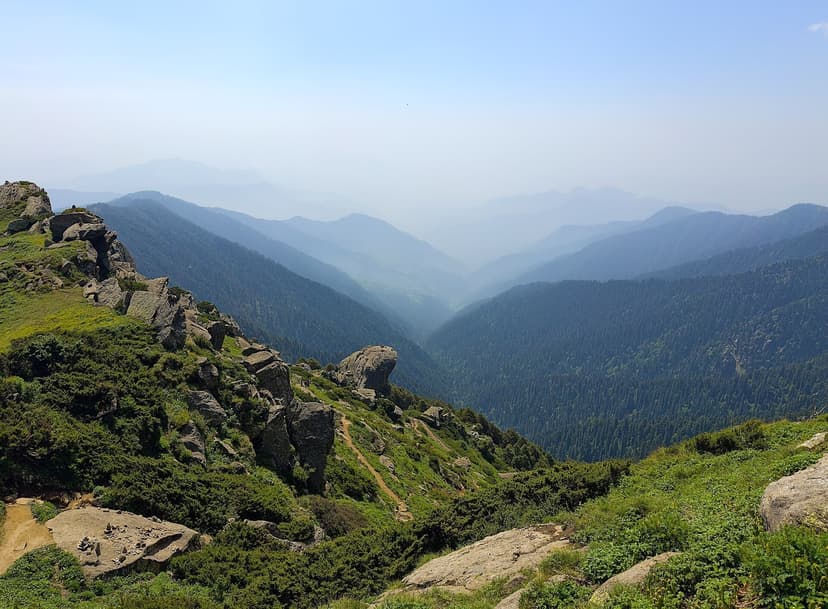
At the top stands the Shirgul Maharaj temple, seat of the great Sirmauri devta, with a towering modern Shiva statue beside the summit boulders. The summit panorama runs from the lights of the Punjab plains on one side to the Garhwal snows, Badrinath and Kedarnath included, on the other. One trekker posted the moment with the caption: "Reaching the top of Churdhar after hours of trekking, and being greeted by this towering Shivji statue… it's hard to explain the feeling. Surrounded by silence and sky" (u/MyTravelOdyssey).
Timing is strict and worth respecting. The shrine stays closed through winter and opens around Vaisakh Sankranti in mid-April; snow sits deep on the upper ridge until then, with an average of 33 feet falling over the season. A local on the Churdhar subreddit thread gave the calendar exactly as the district administration would: "April 15 ke baad best hai aage mid July thak uske baad monsoon aa jayega fir mid sep to oct end" (u/Affectionate-Link881). Mid-April to mid-July, then September to late October. Carry warm layers even in June; the summit camp drops near freezing at night. Keep an eye out for monal pheasants in the kharsu oak, the state bird is a regular here. If you want trek comparisons, our Triund guide covers the famous beginner walk; Churdhar is two grades harder and ten grades emptier.
How to actually do this: routes that work
Lower Himachal does not reward the hub-and-spoke holiday. It rewards corridors. Three that work, depending on who you are.
The Guru Gobind Singh trail, two to three days: Anandpur Sahib, then Naina Devi across the reservoir (the ridge literally looks down on the Khalsa birthplace), Nadaun on the Beas, and finish at Paonta Sahib on the Yamuna. The tenth Guru's geography, end to end, no agency required.
The Shaktipeeth triangle, two days: Chintpurni, Naina Devi, Jwalaji over the Kangra border, with Deotsidh as the natural add-on between them. Devotees do versions of this constantly; as a planned circuit with decent overnight stops, it exists nowhere in print.
The heritage loop is the one I would take, and it is in the itinerary below.
- Day 1: Chandigarh to Nahan (90 km, 2 hrs)
Reach Nahan by mid-morning. Walk the 1621 old town: Rani Tal, the clock tower, bazaar lanes on the princely street plan. Sunset from the Villa Round ridge walk. Overnight Nahan. - Day 2: Renuka Lake and Paonta Sahib (95 km total)
Morning 37 km east to Renuka Ji. Lake circuit on foot, 45 minutes, lion safari park optional. Afternoon drive south to Paonta Sahib. Evening aarti at the gurdwara on the Yamuna, langar dinner. Overnight Paonta or back in Nahan. - Day 3: Across to Bilaspur (200 km, 5-6 hrs)
Long driving day via Nahan, Solan and the Shimla bypass. Reach Bilaspur by late afternoon. Lakefront at Mandi Bharari for shikara or jet ski hour. Overnight Bilaspur. - Day 4: Submerged temples, Bhakra and Naina Devi
Early light is best for the temple shikharas standing in the drawdown zone, visible roughly April to July. BBMB pass from Nangal for the dam viewpoint, ID needed. Ropeway up to Naina Devi for the two-state view. Overnight Bilaspur or Hamirpur. - Day 5: Hamirpur and Sujanpur Tira, exit via Kangra
Morning at Deotsidh cave shrine. Sujanpur Tira fort and the chaugan after lunch, 22 km from Hamirpur town. Exit north to Kangra or Dharamshala, or loop back to Chandigarh via Una.
Want a local sanity-check on your lower Himachal route? Email us your draft itinerary. We will tell you whether the submerged temples are likely to be visible in your week, which day is too ambitious, and where the road has been rough lately.
What it costs
This is cheap travel by Himachal standards because nothing here has tourist pricing yet. Hotel stock is thin: HPTDC properties at Renuka and Bilaspur, mid-range hotels in Nahan and Paonta Sahib, gurdwara sarais for pilgrims. Book ahead during Navratri and the November fair window, otherwise walk-in works almost everywhere.
| Item | Amount (INR) | Note |
|---|---|---|
| Stay, 4 nights mid-range | 6,000 | HPTDC or private hotels, 1,200-1,800 per night for two |
| Self-drive fuel, Chandigarh loop ~650 km | 4,500 | Or HRTC buses for under 1,500 total per person |
| Food, 5 days | 2,500 | Dhaba thalis 120-180; langar at Paonta is free, donate what you can |
| Naina Devi ropeway | 300 | Return ticket, indicative; shut 1st and 3rd Wednesday for maintenance |
| Gobind Sagar water sports | 800 | Shikara or jet ski round at Mandi Bharari, rates vary by operator |
| Entries and parking | 400 | Bhakra pass is free with ID, fossil park entry is nominal |
Planning this as a first Himachal trip and not sure whether lower HP or the classic hills fit you better? Email us with your dates and group, and we will give you a straight answer, including the months when we would tell you to skip the lowlands entirely.
Lower vs upper Himachal, honestly
Should this replace your Manali week? Probably not. It is a different product, and the comparison below is the fairest way I can put it. June in Una is hot in a way no Kullu person will ever voluntarily experience, and there is no high-mountain drama south of Churdhar. What there is: emptiness, temple culture at full strength, water in unreasonable quantities, and history per square kilometre that embarrasses the famous districts.
| Lower Himachal (these 4) | Upper Himachal (the famous 5) | |
|---|---|---|
| Scenery | Shivalik foothills, big reservoirs, river plains, one alpine summit | Snow peaks, deodar valleys, high passes |
| Crowds | Pilgrim surges at temples, empty everywhere else | Tourist crowds at every named viewpoint May-June |
| Best months | October to March, plus April-June for Churdhar and the temple drawdown | March to June, September to November |
| Stay options | Thin: HPTDC, sarais, basic hotels | Everything from hostels to five-star |
| Signature experience | Submerged temples surfacing, Renuka fair, Paonta aarti | Rohtang snow, Old Manali cafes, Spiti circuits |
| Cost for 5 days for two | Around 15,000 self-driven | 25,000 and climbing fast |
One warning so the honesty cuts both ways. If your trip is built around photographs of mountains, you will be disappointed here, and a few locals will tell you so themselves; one Una redditor warned a student off with "हिमाचल की ज़रा भी क्वालिटी नहीं है वहां। पंजाब ही है वो एक तरफ से दूसरा", roughly, it is just Punjab with extra steps. I think he undersells his own district badly. But you should hear the dissent before you book.
FAQ
What are the least visited districts in Himachal Pradesh?
Una, Bilaspur, Hamirpur and Sirmaur, the four southern districts in the Shivalik foothills, get close to zero tourist coverage despite holding HP's largest natural lake (Renuka), the submerged temples of old Bilaspur, Paonta Sahib gurdwara and the Churdhar trek.
When can you see the submerged temples of Bilaspur?
When Gobind Sagar drops, roughly late spring through early summer (about April to July depending on the year), around eight of the 28 drowned temples of old Bilaspur stand clear of the water. The monsoon refill hides them again by August.
Is Nahan worth visiting?
Yes, if a quiet 1621-founded princely capital at 932 m with Rani Tal, intact bazaar lanes and almost no tourists sounds like your kind of town. It pairs naturally with Renuka Lake, 37 km away. September to November is the best window.
What is the significance of Paonta Sahib?
Guru Gobind Singh lived here on the Yamuna for four years from 1685 and composed much of the Dasam Granth, the second scripture of Sikhism, at this site. The gurdwara complex includes the Kavi Darbar poetry court, a weapons museum and a langar that feeds thousands daily.
How hard is the Churdhar trek?
Moderate. It is 16-18 km one way from Nohradhar with a 5-8 hour ascent, two dhaba stops en route, and a summit at 3,647 m. The shrine opens around mid-April after the snow and the season runs to early November, skipping monsoon.
Do you need a permit for Bhakra Dam?
Yes. Visits require a free pass from the BBMB Public Relations Office in Nangal with a valid photo ID, issued roughly 8 am to 3 pm. Foreign nationals are not permitted at the dam under standing security rules.
What are the dates of the Renuka Fair in 2026?
The international Renuka Ji fair runs 20 to 24 November 2026, over the closing days of the Kartik month. Village deities arrive in palanquins to mark Parshurama's annual reunion with his mother Renuka.
Can you do water sports at Gobind Sagar?
Yes. Jet skis, shikara rides, houseboats and a 45-seat cruise vessel operate from Mandi Bharari near Bilaspur, inaugurated in 2026, with a 30 km cruise route toward Tattapani planned. Water levels are highest and best from autumn onward.
Go before somebody builds a viewpoint cafe
These four districts will not stay invisible. Domestic tourism in India keeps spilling outward from the same five saturated destinations, the Gobind Sagar cruise route is the first organised product lower Himachal has ever had, and the day the submerged temples get their island, the reels will write themselves. For now the math is absurdly in your favour: seventeenth-century towns, Shaktipeeth pilgrimage geography, a Sikh literary capital and the roof of the Shivaliks, all within three hours of Chandigarh, all essentially unvisited by anyone who is not praying.
Start with the full HP travel guide for the twelve-district picture. For more empty corners, the offbeat HP list goes north of the snowline. Time a visit with the 2026 festival calendar, eat your way through the seven regional dhams (the Bilaspuri dham has its own madra tradition), and if you are coming by bus, the HRTC guide covers every route in this article.
Sources
- District Bilaspur official: places of tourist interest (Bhakra, Gobind Sagar, Kandrour, Nalwari)
- District Sirmaur official: Churdhar trek
- District Sirmaur official: Renuka Ji
- District Una official: Mata Chintpurni
- Himachal Tourism: Sirmaur
- The Tribune: plan to conserve submerged temples in Gobind Sagar
- The Tribune: CM launches jet skis, shikara rides in Gobind Sagar
- Outlook Traveller: the submerged temples of old Bilaspur
- Tour My India: Sujanpur Tira fort
- Shri Naina Devi official site: history
- Naina Devi Ropeways: timings
- Reddit threads as linked inline: r/HimachalPradesh, r/CampingandHiking, r/india_tourism, r/PhotographyIndia, mined June 2026
- Background reading: Renuka Lake, Gurdwara Paonta Sahib (Wikipedia)
You Might Also Like
Volunteering in Himachal Pradesh: 12 Organisations and How to Apply (2026)
Teach English in McLeod Ganj, conserve the Great Himalayan National Park, build with earth in Bir, or harvest apples in Kullu. Twelve real HP volunteer organisations with honest costs, the visa rule that gets foreigners deported, and how to apply.
How to Travel Himachal Without Wrecking It: A Quiet-Travel Manual
A non-preachy field manual for responsible travel in Himachal, by a Kullu local: how to behave, when to go, where to go instead, and the 2026 rules and bans that actually matter.
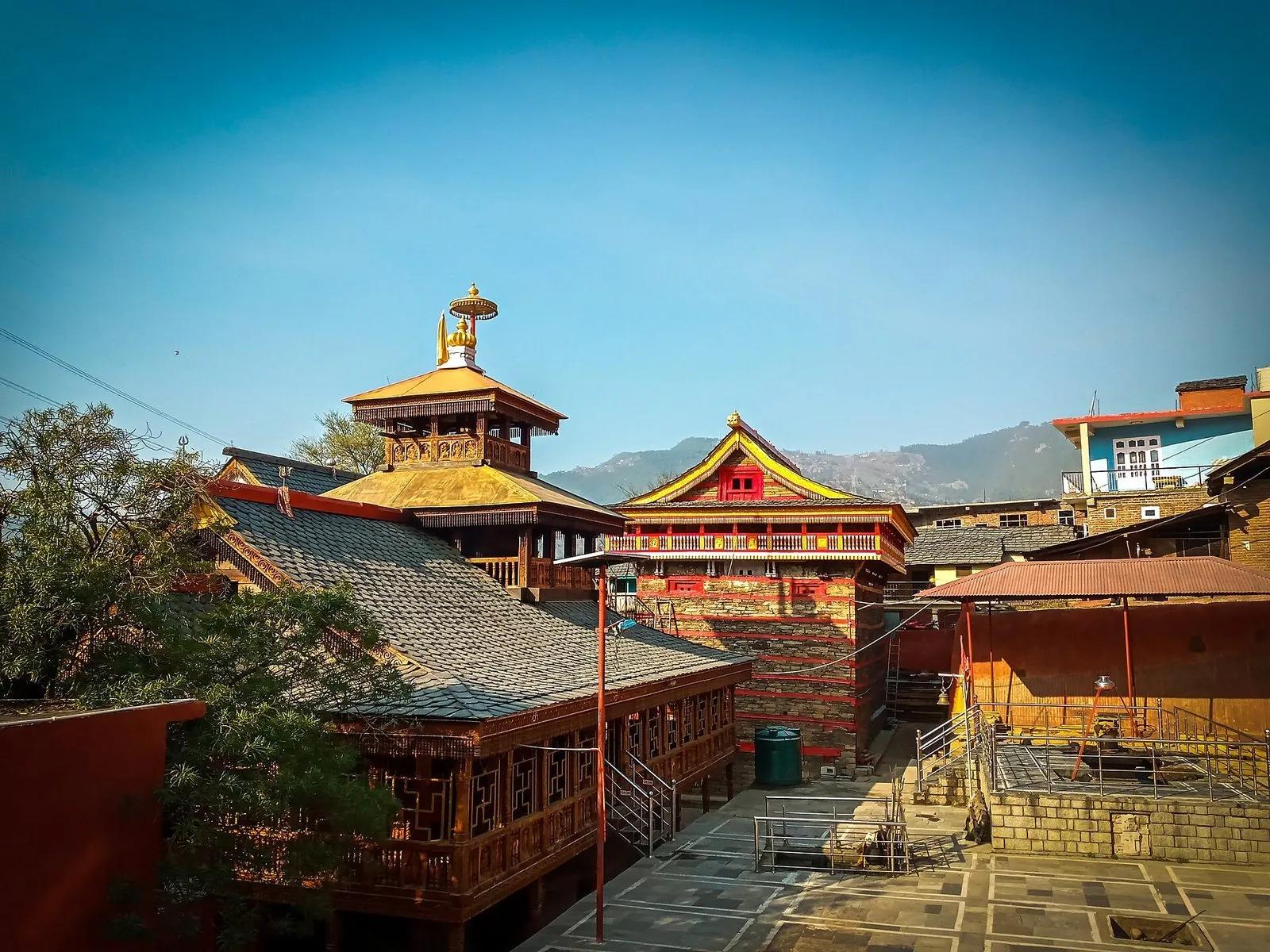
Mamleshwar Mahadev: The Eternal Flame Temple of Karsog
An eternal fire, a fist-sized wheat grain and a six-foot drum, kept in a mortar-less timber temple in the quiet Karsog valley. The honest story of Mamleshwar Mahadev: what is real, what is faith, and how to go.