
Monsoon HP 2026: What Is Actually Open in July-September
Short answer: Most of Himachal in July and August is genuinely unsafe. A small, specific part of it is the safest, cheapest, clearest sky you will see anywhere in north India that month. The trick is knowing which part, and knowing it before you book.
I am from Kullu. The Kullu-Manali highway is the road my valley sits on and the road that breaks every monsoon, and the rhythm of when it closes and when it opens is something locals here grow up learning. What follows is a 2026-verified guide to what is actually open in monsoon HP, what is actually closed, where prices drop, where the river takes the road, and the one geographical feature that makes a Spiti road trip in July a reasonable plan rather than a stupid one.
Quick facts
- 2026 monsoon onset: IMD expects June 20 in northwest India, four to six days early
- 2026 HP forecast: Below normal across most of the state
- 2026 Lahaul-Spiti forecast: Normal to above normal (the rain-shadow gap is smaller this year)
- 2025 death toll: 451 over the season (HP State Disaster Management Authority, final bulletin 23 Sept)
- 2025 events: 19+ cloudbursts, 23+ flash floods, 16+ landslides in early July alone
- Spiti annual rainfall: roughly 170-200 mm, less than Bikaner
- HPTDC monsoon discount 2026: 20-40% off, July 15 to September 12
- What this saves you: the trip itself if Kasol was the plan
The rain-shadow secret, in plain words
HP has a wall through the middle of it. The Pir Panjal runs roughly southeast to northwest, and the Greater Himalayan range sits behind it. When the southwest monsoon rolls up from the Arabian Sea, the moisture hits the south-facing slopes first. Mandi, Kullu, Manali, Kangra, Dharamshala, Shimla, all of these sit on the wet side. Average annual rainfall on this side runs 1,500 to 3,000 millimetres, most of it falling between July and early September.
The other side of the wall is desert. Lahaul gets some spillover from the western edge of the system. Spiti, sitting deeper behind both ranges, gets almost nothing. The annual rainfall in Kaza is between 170 and 250 millimetres in a normal year, depending on which government station you trust, and most of it comes as snow in the cold half of the year. In July, when Manali is getting hit, Kaza is dry. The valley turns warmest, the dust settles after the May winds, and the sky stays a clean ultramarine blue most days.

This year there is a footnote on that pattern. The IMD's April 16, 2026 long-range forecast puts the southwest monsoon at around 92 percent of the long period average across India, and below normal across most of HP. The one exception in the state forecast is Lahaul-Spiti, where rainfall is expected normal to above normal. Parts of Chamba, Kinnaur and Hamirpur are also flagged as near normal. The rain-shadow advantage in 2026 will still exist, but it is narrower than usual. Plan for it, but check the IMD bulletin for your week before you commit.
The structural insight to take away is this. The danger in monsoon HP is not evenly spread. It is concentrated in specific geological zones, and the zones do not respect district lines or the labels on travel websites. The Parvati valley is dangerous, full stop. The Kinnaur stretch above Tapri is dangerous, full stop. The Kullu-Manali highway corridor through Mandi is dangerous in repeating cycles. Outside those zones the picture changes fast.
The zone map: SAFE, MODERATE, AVOID
The categories below are based on three signals layered together. One, recorded landslide and cloudburst density 2018 through 2025, from HP State Disaster Management Authority bulletins, Tribune India coverage and IMD post-monsoon reports. Two, geography, specifically rain-shadow position, river-channel width and slope stability. Three, road infrastructure, mainly whether the access road has a single point of failure or has been re-engineered after a major slide.
| Zone | Where | Why |
|---|---|---|
| SAFE | Spiti corridor (Kaza, Tabo, Dhankar, Key, Langza, Hikkim, Komik, Kibber) | Rain shadow, low annual rainfall, dry valley floor |
| SAFE | Lahaul (Keylong, Jispa, Sissu, Gondhla, Tandi) | Partial rain shadow, Atal Tunnel all-weather access |
| SAFE | Bir-Billing | Kangra belt, moderate rain, cafes and Tibetan colony function in rain |
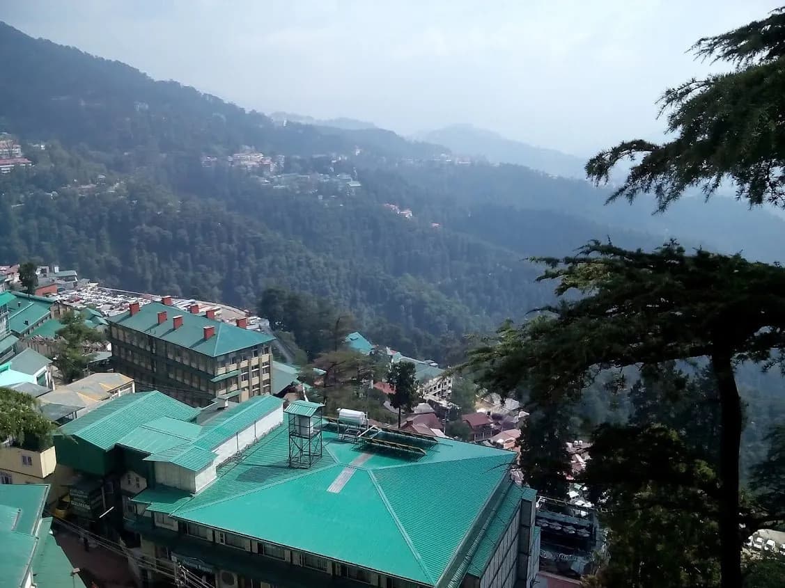
| MODERATE | Shimla | Town itself handles rain; the highways do not |
| MODERATE | Dharamshala and McLeod Ganj | 3,000mm+ a year, but built for it |
| MODERATE | Tirthan and Jibhi | Quieter, less landslide-prone than Parvati, but Aut-Banjar road can take hits |
| MODERATE | Sangla and Chitkul | Lush, but NH-5 through Tapri-Karcham is on the danger list |
| AVOID | Parvati Valley (Kasol, Tosh, Manikaran, Barshaini, Kheerganga) | Flash-flood corridor, narrow valley, repeat closures |
| AVOID | Manali highway via NH-3 (Mandi to Manali) | 148 major landslides in 2025, 144 road closures in Mandi district |
| AVOID | Upper Kinnaur above Tapri-Karcham | NH-5 landslide zone, Nigulsari and Pangi-style cut-offs recurring |
| AVOID | Rohtang Pass old road | Often closed or treacherous; use the Atal Tunnel instead |
Monsoon HP, mapped by zone
Use this map to orient yourself. The east half of the map, Spiti and Lahaul, is rain-shadow country. The Parvati Valley loop south of Manali is the highest-risk zone. The Mandi-Manali highway corridor is the most-broken stretch in 2025 data.
What 2025 actually looked like
You cannot write this article in 2026 without going back through the previous year's body count. The honest framing is that HP had its second-worst monsoon on record in 2025. The state SDMA tallied 451 deaths between 20 June and late September. The 2025 rainfall over the state was 47 percent above normal, with Mandi district recording almost 2,000 percent surplus rainfall on July 1 alone, when nearly a seventh of the district's full seasonal rain fell in 24 hours. By the time the season ended, 710 pucca houses and 1,107 kutcha houses had been fully destroyed, 29,534 livestock had died, and 425 state roads had been closed at some point during the season.
The cluster of incidents in early July was especially bad. Within 24 hours on June 25, 2025, cloudbursts hit Manikaran, Banjar and Sainj valleys in Kullu district, with five homes in Sinyud Viyali village in Banjar washed away and three members of one family reported missing. On July 1 and 2, the Mandi-Manali corridor through NH-3 was hammered, the Kiratpur-Manali highway was blocked for 29 hours by a single landslide near Pandoh, and Kullu Valley took four cloudbursts in 24 hours.
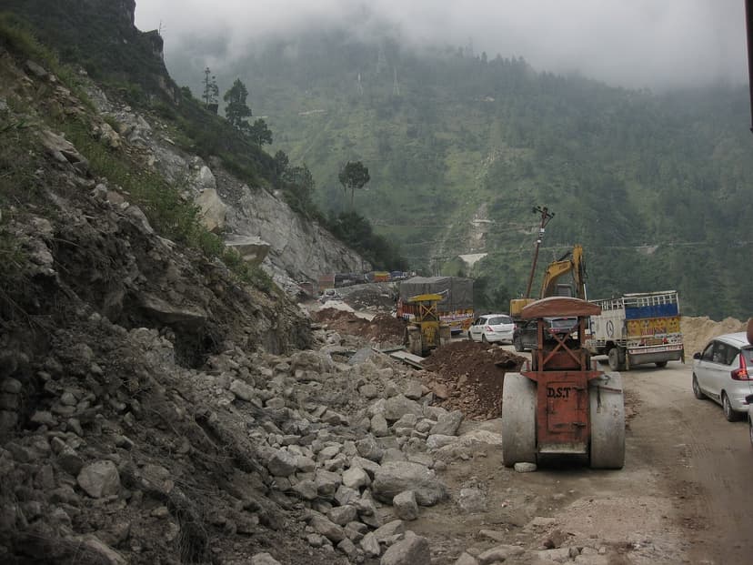
What 2025 taught the state, on top of the everyday geological facts, is that climate change is shifting monsoons from steady rain into intense bursts. The numbers from the Down to Earth review of the 2025 season call this out directly. The same total annual rainfall, delivered in shorter and more violent windows, breaks slopes that handled a steadier monsoon for decades. NDMA's post-monsoon guidance for 2025 explicitly flags this pattern.
This is why "is HP safe in monsoon" is the wrong question. The right question is which parts of HP, in which window, with what buffer days.
The SAFE zone: Spiti, the one place where monsoon helps
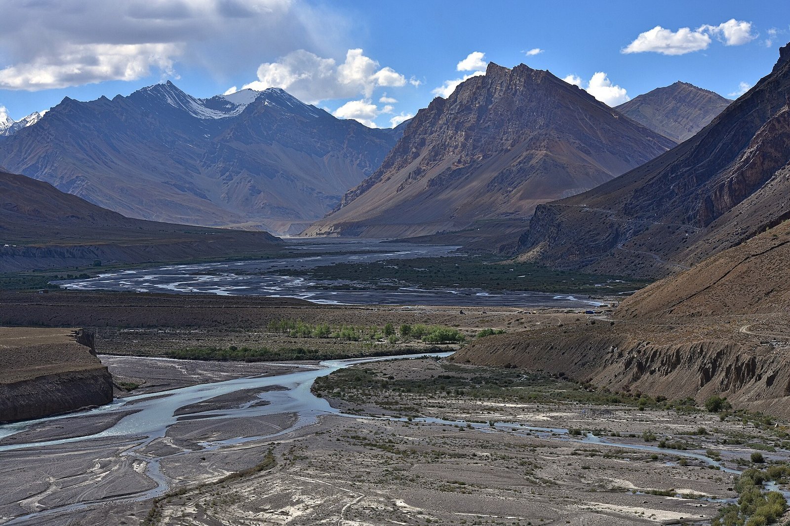
The single most consistent piece of advice on every Spiti thread on Reddit comes from u/HarshVirdi, who put it plainly on a r/india_tourism July-trip thread: "It is completely fine in Spiti as it is a cold desert and it hardly rains there. Manali is a bit tricky so I would suggest you keep an extra day in hand." That is the entire argument in two sentences. The valley is safe. The road in is the work.
Day temperatures in Kaza through July sit between 15 and 25 degrees Celsius. Nights drop to 5 to 10. The monasteries are open. The Chicham bridge is open. The fossil walks at Langza and the post office at Hikkim are running. Pin Valley National Park is at its greenest of the year, which in Pin still means muted ochres and pale greens but is greener than anything else in the corridor. Homestays in Kaza, Tabo, Dhankar, Langza, Kibber and Komik run between Rs 800 and Rs 1,500 a night including two meals, and during monsoon you can show up without a booking in most villages and find a bed.
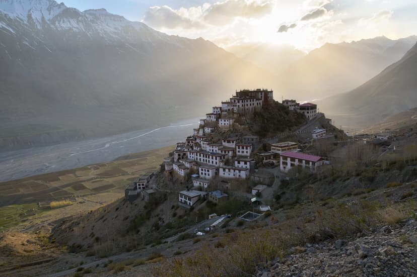
The catch lives on the approach roads. Both the Manali-side entry (through the Atal Tunnel, Gramphu, Batal and Kunzum Pass) and the Shimla-side entry (through Rampur, Nako, Tabo) pass through monsoon-active zones before they enter the rain shadow. Once you are past Losar on the Manali side or past Sumdo on the Shimla side, you are dry. The work is getting that far.
The Atal Tunnel itself is open year-round, 6:00 AM to 10:00 PM. The Lahaul side is light rain, occasional debris flows around the Pagal Nala stretch near Sissu, but generally manageable. The Gramphu-to-Batal stretch is where the road can disappear. Glacial-melt water crossings rise sharply through the day, especially in heavy-rain weeks, and the rule is simple: cross before 10 AM or do not cross. A high-clearance SUV is non-negotiable for this stretch, sedans do not make it.
The early-morning rule in Gramphu-Batal
Through July and August, glacial-melt water crossings between Gramphu and Batal swell every day as the sun warms the snowpack. By noon the crossings are 30 to 50 percent deeper than they were at 7 AM. Start your day at 5 AM if you are crossing this section. The rest of the day can be slow, but the water decisions need to be made early.
The SAFE zone: Lahaul, the under-rated half
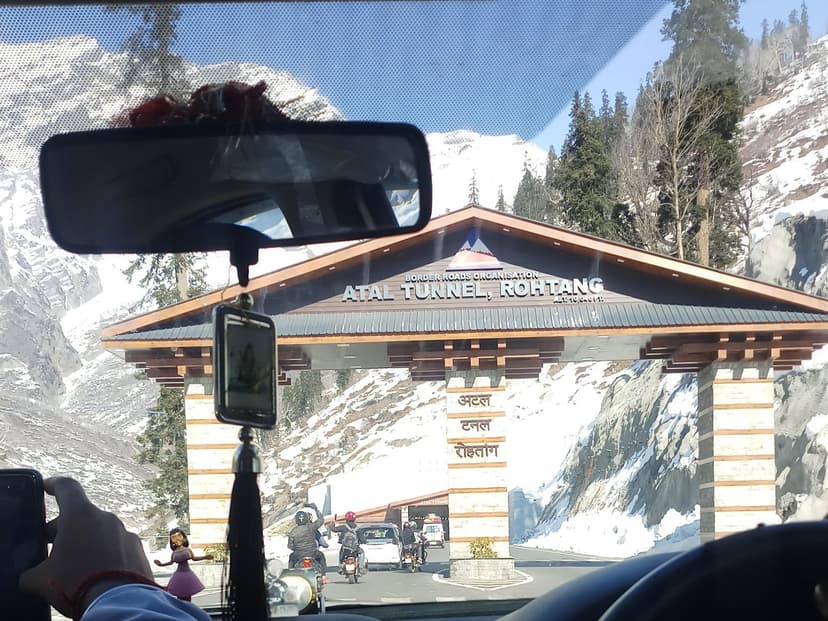
Lahaul sits in a partial rain shadow. The Pir Panjal takes most of the moisture before it reaches Sissu, Gondhla, Keylong and Jispa. The valley does see rain, but it is light, infrequent, and almost never the cloudburst pattern that breaks the Kullu side. The road through Lahaul is the Atal Tunnel approach, then NH-3 along the Chandra River past Sissu and Gondhla into Keylong, then the Manali-Leh highway as it climbs toward Jispa, Sarchu and Baralacha. The Manali-Leh highway is closed in winter, but the Manali-Keylong section is open all summer including monsoon.
What is open in Lahaul in monsoon: Shashur and Kardang monasteries above Keylong, the Sissu waterfall and helipad viewpoint, Gemur Gompa near Keylong, the Tandi confluence where the Chandra and Bhaga meet to form the Chenab, the Triloknath temple on the Pattan side. The Lahaul side of the Sissu road has Zostel and a clutch of homestays running through monsoon at Rs 1,200 to Rs 2,500 a night.
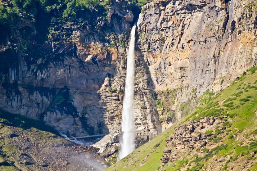
The one stretch to watch on the Lahaul side is the Pagal Nala bend, roughly two kilometres before Sissu when coming from the tunnel. It has caused multi-day road blocks in past monsoons. The HP Lahaul-Spiti district road-status page (hplahaulspiti.nic.in/road-status) carries updates. Check it the morning you drive in.
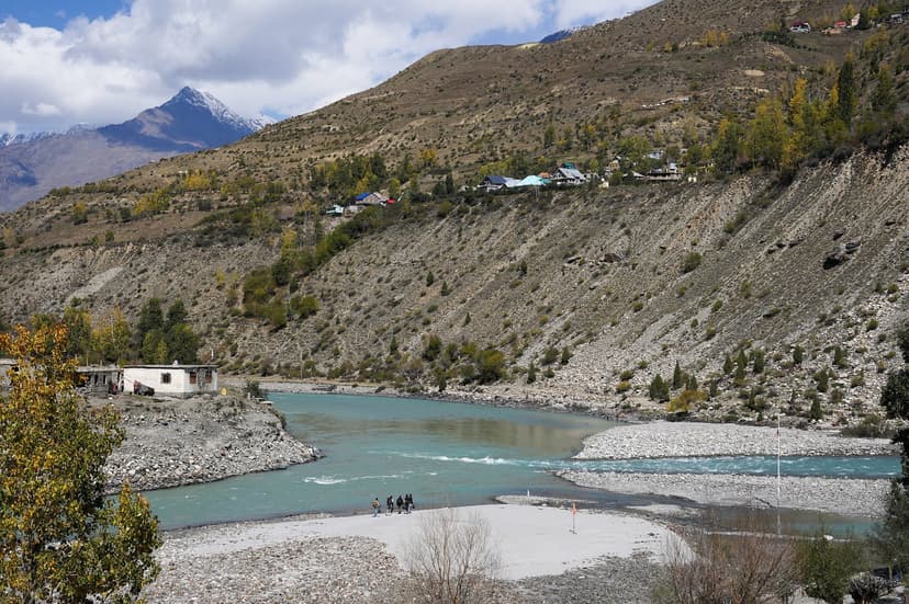
A complete Lahaul-only itinerary is doable in three days and avoids Spiti entirely. Day one, Manali to Sissu through the tunnel, lunch in Keylong, overnight in Jispa. Day two, Jispa to Baralacha as far as the road is open, sometimes only to Patseo before the tourist permit window starts at Sarchu, return to Keylong. Day three, Keylong-Shashur-Kardang-Tandi loop, back through the tunnel by evening. This is the answer if you want mountain time without the Spiti commitment.
The SAFE zone: Bir, the workation that survives monsoon
Bir is in the Kangra belt at around 1,500 metres, north of the main rain corridor. It does rain here, but the geography is gentler than Mandi or Kullu, the slopes are stable, and the road in from Palampur is usually fine. Paragliding is weather-dependent and gets grounded on heavy days, so this is not the trip for adrenaline. What survives in monsoon are the cafes, the Palpung Sherabling and Chokling monasteries, the Tibetan colony, the tea-belt drives between Bir and Palampur, and the WiFi.
If you have to be in Himachal in monsoon and you have a desk job, Bir is the answer. A guesthouse with reliable internet is around Rs 1,200 to Rs 2,000 a night. The two cafes everyone names, June 16 and Garden, run through the season with shorter hours but they are open.
The MODERATE zone: Shimla, the town that holds, the highways that do not
Shimla town itself is built for monsoon. Colonial drainage, stone retaining walls, century-old houses that have seen the rain a hundred times. The Ridge is still walkable in light rain. The Heritage Walk is doable. The Himachal State Museum is dry and good. Mall Road has a flat-topped cover for much of its length. Bars and restaurants run on full schedule.
The danger sits on the four highways into town. NH-5 from Solan and the lower stretches of the Shimla-Rampur road have landslide history. Cloudbursts in Mashobra and Theog tehsils are routine. Shimla district recorded 50+ roads closed in 2025 monsoon. The town can be perfectly fine while the only road in is being cleared.
If Shimla is the plan, my honest advice is to take HRTC Volvo, not your own car, and to be flexible by a day. The Volvo runs whether or not your nerves agree with the conditions, and the drivers know which valleys to avoid. The Kalka-Shimla narrow-gauge toy train (the heritage line that was a UNESCO listing in 2008) also runs through monsoon but has its own landslide closures and is more atmospheric than reliable.
A useful adjacent option to Shimla in monsoon is Chail, 50 kilometres south. Lower altitude, less rain, calmer roads. Chail does not face the major flooding or landslide pattern that Mashobra and Theog do, and the HPTDC Palace Hotel Chail is on the 40-percent-discount list (more on that below).
The MODERATE zone: Dharamshala and McLeod Ganj, monsoon city by design
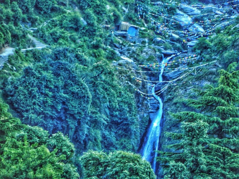
Dharamshala and McLeod Ganj are among the wettest hill stations in India. The annual average is north of 3,000 millimetres, most of it July and August. This is genuinely the kind of monsoon where the windows fog from the inside and a five-minute walk soaks through everything you are wearing. The Dhauladhars vanish into cloud for weeks. The Bhagsu waterfall, normally a forty-minute walk up from Bhagsu Nag temple, becomes a thundering cascade that has injured climbers and washed away the railings in past seasons.
The reason Dharamshala still rates as MODERATE rather than AVOID is that the town is built for this. Medical facilities are good. Internet works, mostly. McLeod Ganj's cafe culture (Common Ground, Moonpeak, Cafe Budan, Lhamo's Croissant) is at its best in moody weather. Namgyal Monastery, TIPA, Tushita Meditation Centre, the Library of Tibetan Works and Archives, all operate through monsoon. The Dalai Lama himself rarely teaches during the wettest weeks but the temple complex stays open.
The catch is the access road from Pathankot. Manuni Khad and other side streams running across the Pathankot-Mandi highway have landslide and washout history. The 2025 season closed this corridor on three separate occasions. If you are coming up by train, the Pathankot station is the safer end-point and a private taxi from there to Dharamshala does the job. Coming up from Delhi by road, plan a buffer day in Pathankot in case the hill ascent has been suspended.
The MODERATE zone: Tirthan, Jibhi, Sangla
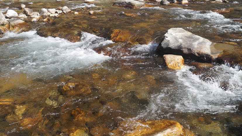
The Tirthan and Jibhi valleys are softer monsoon options than anything in the Parvati zone. They sit at gentler altitudes (1,500-2,000 metres), the river channels are wider, the slopes are forested rather than bare and gravelly. The Great Himalayan National Park at the head of the Tirthan valley turns its greenest of the year. Waterfalls along the Tirthan are at full roar. The Jibhi waterfall and Jalori Pass area are still walkable in light rain.
The risk lives on the Aut-to-Banjar road that gets you in. The stretch through the Aut tunnel and along the Sainj corridor can take landslide hits, and the 2025 season saw the Aut-Banjar road closed on multiple days. If you are coming from the Mandi side, check the Banjar tehsil road status before you start. If you are already in the valley, you are fine.
Sangla and Chitkul in upper Kinnaur are a different story. The valley itself is staggeringly green in August, apple orchards heavy with fruit, the Baspa river at full flow. The risk is NH-5 between Rampur and Sangla, specifically the Tapri-Karcham-Nigulsari stretch. This is a known landslide corridor. If you are going, do it with flexible dates and buffer days. The HP PWD updates are the right source.
The AVOID zone: Parvati Valley, in honest terms
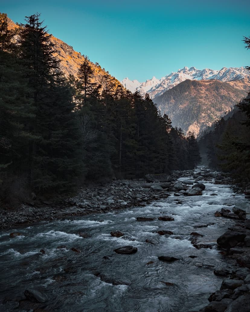
If there is one section of this article to read carefully, it is this one. The Parvati Valley is the single highest-risk corridor in HP during the monsoon. This is not a moral judgement, it is a geographic fact. The valley narrows sharply between Bhuntar and Kasol, steepens further as you climb toward Manikaran, narrows again past Barshaini. The Parvati River drops nearly 1,800 metres in 90 kilometres from Mantalai to Bhuntar, which is a textbook flash-flood profile.
The Reddit consensus is unusually unanimous on this. u/Ambitious_Lack1117, who identifies as a Kasol local, posted: "I am from Kasol, do not think it is a good time to be here, monsoons are very beautiful, and it is not rained for the past one week, but the weather is highly unpredictable." Across the major monsoon-safety threads on r/SoloTravel_India and r/HimachalPradesh, the top-voted reply to "is Kasol safe in monsoon" is consistently "do not." u/at_plato put it in Hindi, with the local sarcasm intact: "Aa ja bhai, bs aati baar ek kaam kari, thoda sa road bhi layi pack kar ke apne bag main. Voh na hmara road Parvati ji le gye." (Come, but bring some road back in your bag. The river took ours.)
"I am from Kasol, don't think it's a good time to be here, monsoons are very beautiful... but the weather is highly unpredictable. The season starts after September mid."
by u/Ambitious_Lack1117, r/HimachalPradesh
The Manikaran-Barshaini road was blocked by a massive landslide in 2025, stranding travellers for multiple days. The Manikaran cloudburst on June 25 hit Banjar and Sainj valleys at the same time. Two people were swept away near Kasol in early monsoon 2025 as the Parvati level rose suddenly. None of these are freak events. They are the everyday pattern of a valley that does not have the geological capacity to take what the modern monsoon is delivering.
The Reddit advice is also unanimous on the alternative. Wait until late September. Kasol is open and gorgeous from late September through November and again from March to May. The two months it is genuinely dangerous to visit are roughly the same two months it is closed in spirit, July and August.
The AVOID zone: the Mandi-to-Manali highway
NH-3 from Mandi to Manali is the highway most Indian tourists know best, and the highway that breaks most often. The 2025 season recorded 144 road closures in Mandi district alone, 110 in Kullu. The Kiratpur-Manali stretch was blocked for 29 hours by a single landslide near Pandoh. The Chandigarh-Manali stretch went on suspended traffic for three days in July. The cloudbursts of July 1 and 2 took out infrastructure that had survived the previous decade.
If you must go to Manali in monsoon, the honest version of the trip is one to two buffer days each way, a flexible booking that can be postponed, and HRTC Volvo rather than your own driving. The bus drivers have the road updates, and HRTC will hold you in a roadside dhaba for six hours rather than risk the bend. Self-driving Delhi-Manali in monsoon is a tail-risk bet against a slope that has been wet for 30 days.
"Dont just dont, it's taking anywhere between 2-5 hours to go from Manali to Kullu. Cuz the highway got washed away."
by u/anshu673, r/HimachalPradesh, August 2023 monsoon
"Mid August, last year, I had to walk 20 km downhill through landslide debris because I had an exam the very next day. I suggest you visit after September 15."
by u/outlawent21, r/HimachalPradesh
The AVOID zone: Upper Kinnaur and Rohtang Pass
NH-5 above Tapri-Karcham is on the high-risk list every year. The Nigulsari landslide complex has taken lives in 2021 and again in 2024. The Pangi Valley landslide on April 7, 2026 (verified via Tribune India and Daily Excelsior coverage) destroyed a 60-metre stretch of the Sansari-Kullu-Manali road and stranded around 40-50 people overnight in private vehicles and taxis, with BRO clearing work taking days. This is shoulder-season, before the monsoon proper. The mid-monsoon picture is worse.
Rohtang Pass itself (3,978 metres) is closed or treacherous through much of July and August. The Atal Tunnel bypasses Rohtang completely, and there is no reason to take the old road in monsoon unless the goal is the specific view, in which case wait for September.
What 282 Redditors actually said about monsoon HP
The mother thread on HP monsoon safety is "Is it safe to travel to Manali in first of August?" on r/HimachalPradesh, with 21 comments and a clear local consensus. Read alongside three sibling threads on r/SoloTravel_India and r/HimachalPradesh (1k6irxz, 15j0ywk, nuyb97 by Pullpush IDs), it gives a fair cross-section of what travellers and locals actually advise.
"I live in Patlikuhal, right now only the mountain route is available from Naggar to Manali, but the roads should be open within a week. It is still beautiful and safe, but there is a chance of another flood and then you get stuck without outside contact for 5 days again, haha. Risk it."
by u/circlejerkingdiva, r/HimachalPradesh (Kullu local)
"Jindagi pyaari nhi h to aa jao. News nhi dekhi kya bro?"
by u/ramdhari, r/HimachalPradesh (translation: if your life is not dear to you, come. Have you not seen the news?)
"If you really want to thank, please do not visit HP or any other hill state during monsoons. PLEASE. And also relay this information to every other person you see."
by u/Nal_Neel, r/HimachalPradesh "Thank You Himachal" thread, 148 upvotes
"Brother, as you are a pahadi too, you must be knowing that it is not the best idea to travel in higher hills during monsoon. Please wait for atleast three weeks or maybe four, by then, monsoon almost sweeps away."
by u/outlawent21, r/HimachalPradesh
The contrarian view, the one that defends the trip if you do it right, is best stated by u/HarshVirdi on r/india_tourism. The argument: stick to Spiti, plan buffer days, do not commit to a rigid itinerary, accept that the journey is the work, but the destination itself is fine. This is the position my own experience supports.
HPTDC monsoon discounts 2026, the actual list
The official HPTDC monsoon discount runs from July 15 through September 12, 2026, and applies to room tariffs and event bookings at most government hotels. The list below is from the HPTDC monsoon bonanza announcement covered by Himachal Tonite, Himachal Headlines and HimbuMail in early 2026.
HPTDC monsoon 2026, official discount list
- 40% off: Rose Common Kasauli, Hotel Hatu Narkanda, Chail Palace, The Golf Glade Naldehra, Hotel Manimahesh Dalhousie, Hotel Geetanjali Dalhousie, Hotel Apple Blossom Fagu
- 20% off: Hotel Baghal Darlaghat, Bushahr Regency Rampur, Tourist Inn Rewalsar, Hotel Silvermoon Kullu, Hotel Sarvari Kullu, Hotel Shrikhand Sarahan, Hotel Rohtang Manalsu Manali, Hotel Chanshal Rohru
- No discount: Hamir Hotel, Willy Park, Champak, Hotel Suket, The Spiti in Kaza, Kinnar Kailash in Kalpa, Hotel Chandrabhaga Keylong
- Special exclusions during fairs: Hotel Iravati Champak July 27 to August 3 (Minjar Fair); Hotel Gaurikund Bharmour August 11 to September 1 (Manimahesh Yatra arrival window)
A useful read of this list: the no-discount properties are mostly in genuinely dry-zone destinations (Kaza, Kalpa, Keylong) where occupancy stays solid because tourists who know what they are doing book those rooms anyway. Discounts are concentrated where HPTDC expects empty rooms during the wet weeks. If you are going to take a discount, the Naldehra, Chail, Dalhousie and Fagu properties are the best value, because they are in genuinely scenic locations that the monsoon does not destroy.
Private hotels and homestays follow the same pattern in non-government properties. A Rs 2,000 peak-season room in Old Manali drops to Rs 1,000-1,400 in monsoon. Spiti homestays go to Rs 800-1,500 a night including meals. Old Manali hostels (Zostel, GoStops) drop dorm beds to Rs 400-600 from Rs 800-1,200 in peak. Across a 5-day trip, the savings are real, somewhere between Rs 2,000 and Rs 6,000 a person versus May-June rates.
What you can only do in HP in monsoon
There are seasonal activities that genuinely only work in July and August, and missing them means missing a third of what makes the state interesting.
Waterfalls at peak flow. Jogini Falls above Manali is a different waterfall in July than in April, the volume roughly triples. Bhagsu in McLeod Ganj is at its loudest. Rahala on the Manali-Rohtang road, Chadwick in Shimla, and Sissu in Lahaul are all at their most dramatic. Use a lens hood or umbrella to shield from spray, neutral density filters for the silky water effect, and waterproof camera covers.
The green explosion. August is the most photogenic month for landscape photography in HP. Hills that are brown and golden in winter become emerald. Rice terraces around Kullu and Mandi fill with water and reflect the sky. The cloud forests in Tirthan, Jibhi and the Kullu valley above Naggar are misty in a way that the dry months never deliver.
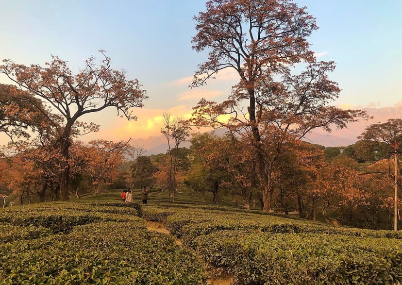
Tea harvest season. Kangra orthodox tea has two flushes a year, and the second flush, July and August, is the one that built Palampur. Visit Wah Tea Estate, Bundla Tea Estate or one of the smaller gardens around Palampur to see the active pluck, the rolling and oxidation, fresh-flush tasting. This is genuinely only available in these two months.
Monsoon treks for the careful. Triund is doable with grippy boots and acceptance of slipperiness. Shali Tibba near Shimla is atmospheric. Hampta Pass has a narrow window in early July, before the heaviest rain weeks. Bhrigu Lake is similar. Pin Parvati is expert-only and not really doable in monsoon, the river crossings on the Parvati side become impossible.
Monsoon festivals. Gemur Gompa hosts a devil dance by red-robed lamas in July. The Sissu village monastery runs a dance-drama sequence annually in mid-monsoon. The Minjar Fair in Chamba runs July 27 through August 3, 2026, and Manimahesh Yatra runs September 4-19 (the official Bhadon dates from the HP government Chamba site, with the pilgrim arrival window starting earlier from mid-August). These are seasonal-only experiences.
The smart monsoon route: an 8-day Manali to Spiti loop
8-day Manali to Spiti loop, monsoon edition
- Day 1, Arrive Manali: rest, check road conditions, stay Old Manali
- Day 2, Manali to Sissu or Jispa: through Atal Tunnel, 3-4 hours, Sissu waterfall stop
- Day 3, Jispa to Kaza: 6-7 hours via Kunzum Pass, start 5 AM, cross water sections before 10 AM
- Day 4, Kaza base day: Key Monastery, Kibber, Chicham bridge
- Day 5, Langza-Hikkim-Komik: fossil walk, highest post office, highest village
- Day 6, Kaza to Tabo via Dhankar: 1,000-year monastery, cliff monastery, overnight in Tabo or Dhankar
- Day 7, Pin Valley or buffer day: use as flex if weather delayed any earlier day
- Day 8, Return Tabo to Manali: 6-8 hours, long day, end at Manali
The Shimla-side alternative reverses days 2 through 8, entering Spiti via Rampur, Nako and Tabo, exiting via Kaza, Atal Tunnel and Manali. The Shimla approach is sometimes described as safer in monsoon than the Manali side, but the 2025 season showed both approaches taking hits. NH-5 between Rampur and Tapri saw multiple closures. There is no risk-free route. The Atal Tunnel is more predictable for the moment you turn into Lahaul, which is the argument for entering from Manali.
If you are already in HP and the monsoon hit
This is the section for travellers who planned a summer trip in good faith, arrived in June, and are now watching the weather report.
If you are in Manali, the move is the tunnel
Head through the Atal Tunnel to Sissu or Jispa. You go from wet to dry in roughly 10 kilometres. The tunnel itself stays open 6 AM to 10 PM in monsoon. If the Lahaul side has a Pagal Nala block, you may need to wait in Manali for a day, but the move is still the right move when the road clears.
If you are in Kasol or Parvati Valley, leave
Drive down to Bhuntar as soon as possible. From there, either head to Manali (and onward via the tunnel) or back toward Mandi and Chandigarh. The Manikaran-Barshaini road is the highest-risk stretch in the valley, get below it. Camp at elevation if you cannot move yet, never at riverside.
If you are in Shimla, stay put or head to Chail
Shimla town handles monsoon. The Heritage Walk, Himachal State Museum, Viceregal Lodge and the cafe street will all keep you occupied. If you need a calmer base, Chail is 50 km south, less crowded, less landslide-prone. Do not drive to Kinnaur or Manali in heavy weather.
If you are in Dharamshala, embrace it
This is the city that was designed for rain. Common Ground, Moonpeak, Cafe Budan, the Tibetan Library, Namgyal Monastery and TIPA classes all run through the wet weeks. Exit route is Pathankot rather than back through Mandi. From Pathankot, trains to Delhi run on schedule.
If you are in Spiti, you are already in the rain shadow
Relax. The valley is dry. The risk lives on your exit route. Monitor Atal Tunnel road status and Kunzum Pass conditions. If conditions worsen, extend your stay in Kaza rather than commit to the Gramphu-Batal stretch in bad weather. The state disaster helpline is 1077, the national number is 112.
The universal contingency kit for any monsoon HP trip: HP PWD road-status link saved offline, HRTC bus tracking app installed, Google Maps offline maps downloaded for all of HP before you leave network, Rs 5,000-10,000 in cash for ATM dead zones, motion sickness medication for the wet-mountain-road combination, two to three buffer days built into any itinerary, and travel insurance that covers natural-disaster delays. The insurance is not optional in monsoon. Most domestic policies cover it for an extra Rs 200-400 on the premium.
Month-by-month monsoon breakdown
| Window | Conditions | Verdict |
|---|---|---|
| Early July (1-15) | Monsoon arriving, rain intensifying in south HP. Spiti and Lahaul still excellent. | Best window to enter Spiti before peak. |
| Late July (16-31) | Heavy rain in Kullu, Mandi, Kangra. Landslide activity climbing. | High risk on highways, low risk in rain shadow. |
| August (full month) | Peak monsoon. Maximum rainfall, max landslide risk on approaches. | Worst month for highways, best for waterfalls and tea harvest. |
| Early September (1-15) | Rain reducing but rivers still high, road repairs ongoing. | Tail-end budget deals; damage from earlier weeks slows things. |
| Late September (16-30) | Post-monsoon. Skies clearing. Kunzum may close late. | Best clear-sky photography. Spiti season closing. |
Packing for monsoon HP
The packing list below is the version I actually use, edited for the rain-shadow trip rather than the wet-side trip. If you are going to Spiti, you need both rain gear (for the approach roads) and cold-weather layers (because Spiti nights are 5-10C even in July).
Rain protection: a genuine waterproof jacket (not water-resistant, the difference matters), waterproof boots with aggressive tread (sneakers turn into death traps on a wet trail), quick-dry trekking pants (not jeans), a compact umbrella for town use, a dry bag or waterproof daypack for electronics.
Layers for Spiti nights: merino or synthetic base layer, fleece mid-layer, down jacket (yes, even in July, the rain shadow is also a cold desert), rain shell on top.
Electronics: waterproof phone case, power bank (electricity drops during storms), Google Maps offline downloaded for HP before you leave network, a ziplock bag or rain cover for the camera, a microfibre cloth for lens drying.
Health and emergency: motion sickness medication, Diamox for Spiti (3,800m plus), basic first-aid kit, ORS sachets, headache medication, a printed copy of your insurance number, the HP disaster helpline saved in your phone (1077) and the national number (112).
The verdict: who should and should not visit HP in monsoon
The honest answer is that the monsoon HP trip works for a specific kind of traveller and is wrong for everyone else.
It works if: you want Spiti and you are willing to flex on dates by a day or two, you are a photographer who values waterfalls and green landscapes and atmospheric mist, you are on a tight budget and want premium experiences at off-season prices, you are already in north India and want mountain time without the May-June crowds, or you accept that the journey is the work and the destination is the reward.
It does not work if: you have a rigid day-by-day itinerary you cannot move, you are nervous about mountain driving in rain, you are planning Kasol or Parvati Valley or interior Kinnaur, you have very young children or elderly travellers who cannot handle multi-hour road delays, or your only available dates are mid-August in the Kullu corridor.
The misconception worth correcting is that all of HP is the same place in monsoon. It is not. The state has at least three different climate regimes through July and August, the wet south-facing side, the partial rain shadow of Lahaul, and the full rain shadow of Spiti. Treating them as one is what kills the trip. Treating them separately is what saves it.
If you want help planning a monsoon Himachal trip, with road-status checks the day before each leg and the kind of local-knowledge filtering that the public bulletins do not give you, write to hello@refuje.com. The team I work with does this work in season every year.
Frequently asked questions
Is it safe to visit Himachal Pradesh in July?
Yes, if you choose the right places. Spiti and most of Lahaul sit in the rain shadow and are genuinely safe and dry in July. Shimla and Dharamshala town are also fine, though their access highways can take hits. The Manali highway corridor through Mandi, the Parvati Valley around Kasol, and upper Kinnaur above Tapri are not safe in July and are best avoided.
Is Spiti Valley safe during monsoon?
Spiti itself is a rain-shadow desert and gets less than 200 mm of rain annually, almost none in July-August. It is actually the warmest and most comfortable month in Spiti. The risk is on the approach roads, the Gramphu-Batal stretch on the Manali side and NH-5 on the Shimla side. Once you are past Losar (Manali side) or past Sumdo (Shimla side), you are in the rain shadow.
How much cheaper is HP in monsoon compared to peak season?
HPTDC government hotels offer 20-40% off from July 15 to September 12. Private hotels and homestays drop 30-50%. A 5-day trip typically saves Rs 2,000-6,000 per person versus May-June peak. Spiti homestays at Rs 800-1,500 a night including meals are the standout value.
Is the Atal Tunnel open in monsoon?
Yes. The Atal Tunnel is an all-weather, all-season tunnel that runs 6 AM to 10 PM. It is closed only during emergency conditions, which are rare. The Lahaul side past the tunnel sees light rain but stays open. The one watch-list point is the Pagal Nala stretch near Sissu, which has caused multi-day blocks in past monsoons.
Which route to Spiti is safer in monsoon, Manali or Shimla?
Neither is risk-free. The Manali side through the Atal Tunnel is more predictable for the tunnel itself, but the Gramphu-Batal section has glacial-melt water crossings that swell through the day. The Shimla side through Rampur, Nako and Tabo has been better-engineered in places, but NH-5 has its own landslide corridor between Tapri and Karcham. Most monsoon travellers prefer entering via Manali and exiting via Shimla, which spreads the risk across both approaches.
What if I get stranded by a landslide?
Stay calm, stay at higher ground (never at riverside), monitor the HP disaster helpline (1077) and the national number (112) for updates. Hotel staff are experienced with these scenarios and will advise. Carry cash, offline maps, a power bank and two to three buffer days. Travel insurance that covers natural-disaster delays is not optional in monsoon.
Can I do paragliding in Bir during monsoon?
It is weather-dependent. Operators ground flights during heavy rain or wind, but may fly between showers in lighter spells. Do not plan a Bir trip purely for paragliding in July or August. Plan for cafes and monasteries, and treat any successful flight as a bonus.
Are short treks safe in monsoon?
Short treks like Triund and Shali Tibba are doable with proper waterproof boots and a careful pace. The trails get slippery, leeches show up on forest sections, and the views are often clouded over. Multi-day high-altitude treks like Hampta Pass and Pin Parvati carry serious risk in mid-monsoon. Always use a guide for monsoon treks, even on routes you have done dry.
When does the monsoon actually end in HP?
Typically the monsoon retreats by mid-to-late September. The post-monsoon clarity through late September and October is the best photography window of the year. By mid-October the high passes start closing for winter, Kunzum first, then Baralacha, then Rohtang.
Should I buy travel insurance for monsoon HP?
Yes. Specifically look for policies that cover trip delays and cancellations due to natural events. Most domestic policies add this for Rs 200-400 on the base premium. Monsoon disruptions are near-certain on some routes, so the insurance pays for itself.
Is there a single number to check road status before driving?
Yes, two. The HP PWD road-status page (himachal.gov.in/en/road-status) carries district-level closures. The HP Lahaul-Spiti district has its own page at hplahaulspiti.nic.in/road-status which is the most current source for the Atal Tunnel side. Check both the night before and the morning of your drive.
Sources
- IMD Shimla Meteorological Centre (April 16, 2026 long-range forecast, HP below normal except Lahaul-Spiti)
- Tribune India, IMD 2026 monsoon onset
- DD News, HP monsoon fury and 2025 death toll
- Down to Earth, Western Himalayas extreme weather review 2025
- Explore Our India, HP cloudburst flash flood landslides July 2025 update
- Himalayas Digital, monsoon 2025 do-not-travel review
- Daily Jagran, Kiratpur-Manali highway 29-hour landslide closure
- Tribune India, cloudburst Kullu Parvati Valley 2025
- The Logical Indian, Manikaran-Barshaini landslide 2025
- Early Post Daily, Pangi Valley April 7 2026 landslide cut-off
- Tribune India, Pangi Valley landslide April 2026
- HimbuMail, HPTDC monsoon discount official list 2026
- Himachal Tonite, HPTDC monsoon discount confirmation
- Himachal Headlines, HPTDC up to 40% discount
- Discover with Dheeraj, Spiti Valley in monsoons (route conditions, water crossing timing)
- Discover Kullu Manali, Atal Tunnel highway status 2026
- HP Lahaul and Spiti district, official road status page
- Holidify, Spiti rainfall annual data
- HP Chamba district, Manimahesh Yatra 2026 dates
- Manimahesh Yatra HP Government registration portal
- r/HimachalPradesh, "Is it safe to travel to Manali in first of August" thread
- r/HimachalPradesh, "Is August a good time to visit Kasol" thread
- r/HimachalPradesh, "Thank You Himachal" thread (148 upvotes)
- r/india_tourism, "I'm planning a trip to Spiti Valley this July" thread
Written from Kullu town, where the road that this article is about closes every year and locals have learned the rhythm of when to drive and when to wait. Last updated for 2026 monsoon season, April 17, 2026.
Plan ahead: if you want a personalised route through the rain shadow with the day-by-day road-status work done for you, drop a line to hello@refuje.com. We do this every monsoon for travellers who want Spiti without the highway gamble.
About Rajesh Thakur
Rajesh Thakur grew up in the Kullu valley and has been writing about Himachal Pradesh travel and culture since 2018. He is most at home in upper Kullu, Lahaul, and the Spiti circuit, and has driven the Manali-Kaza loop more times than he has counted.
You Might Also Like
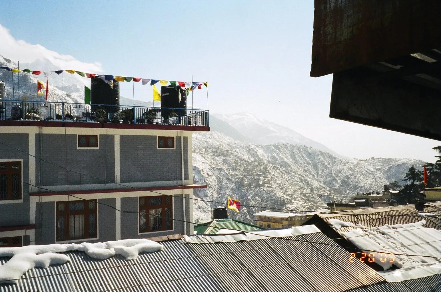
Volunteering in Himachal Pradesh: 12 Organisations and How to Apply (2026)
Teach English in McLeod Ganj, conserve the Great Himalayan National Park, build with earth in Bir, or harvest apples in Kullu. Twelve real HP volunteer organisations with honest costs, the visa rule that gets foreigners deported, and how to apply.
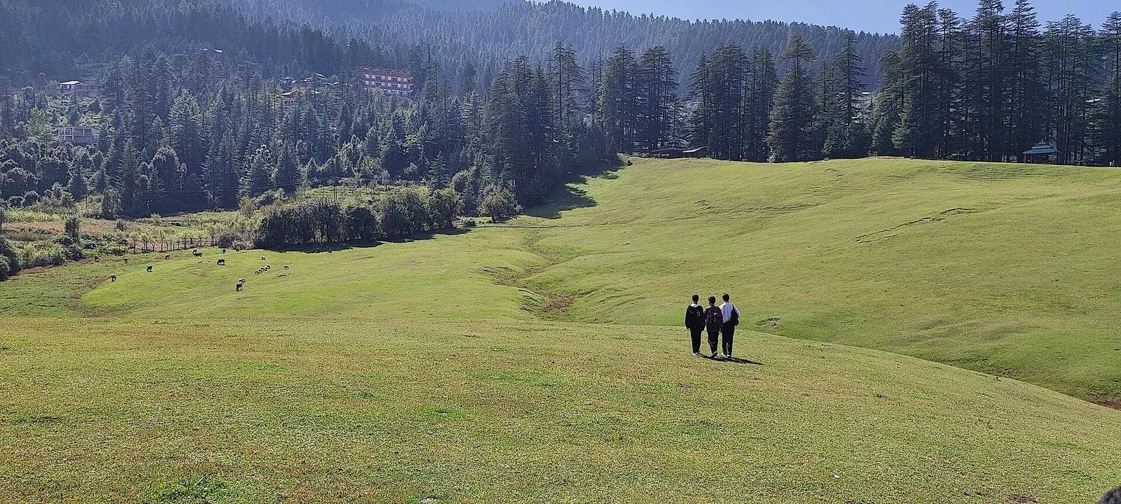
How to Travel Himachal Without Wrecking It: A Quiet-Travel Manual
A non-preachy field manual for responsible travel in Himachal, by a Kullu local: how to behave, when to go, where to go instead, and the 2026 rules and bans that actually matter.
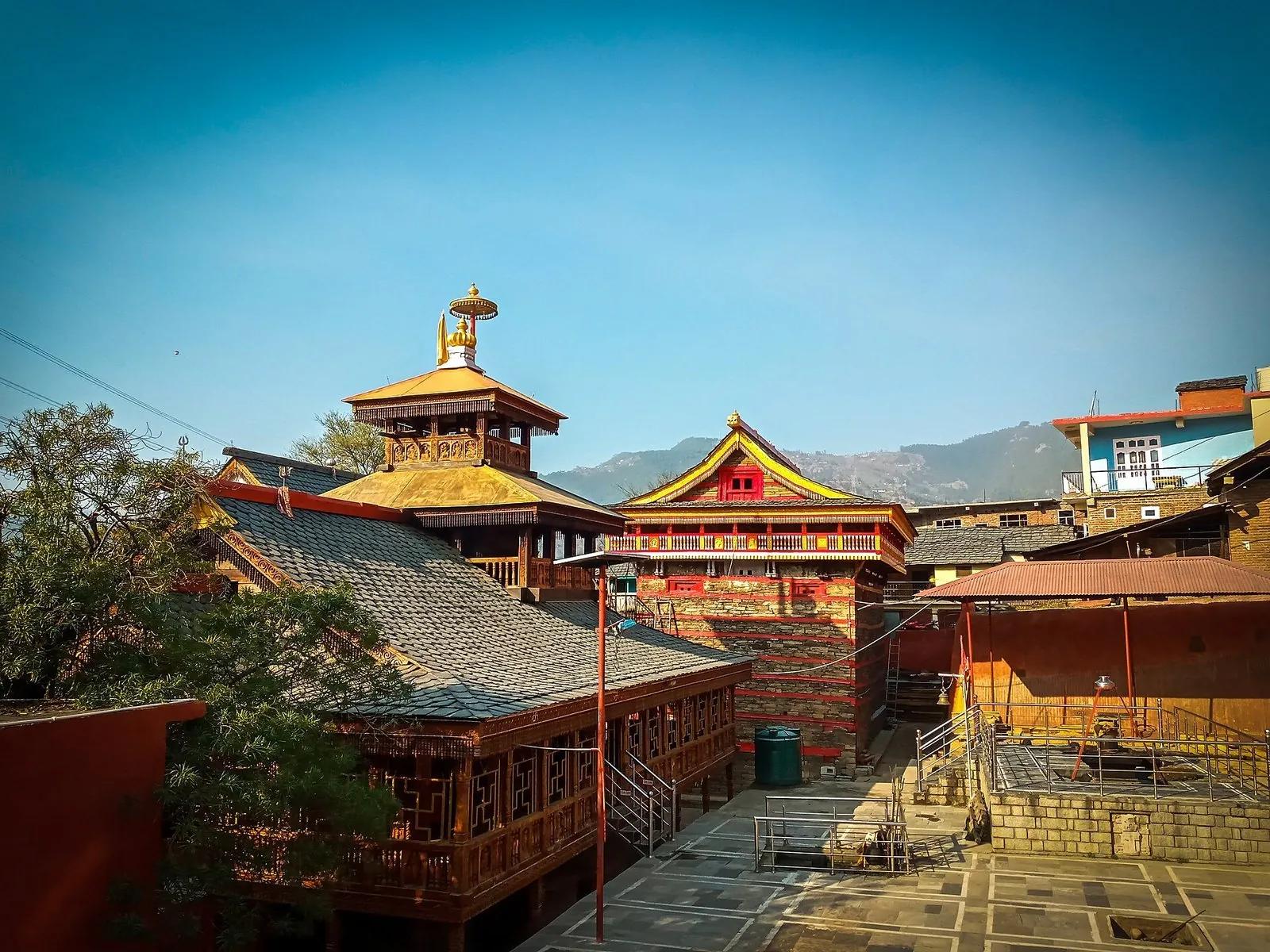
Mamleshwar Mahadev: The Eternal Flame Temple of Karsog
An eternal fire, a fist-sized wheat grain and a six-foot drum, kept in a mortar-less timber temple in the quiet Karsog valley. The honest story of Mamleshwar Mahadev: what is real, what is faith, and how to go.